Satellites play a crucial role in modern space exploration, serving as the backbone for communication, navigation, and scientific research. These sophisticated machines enable us to study distant planets, monitor Earth’s environment, and even search for signs of life beyond our planet. In this article, we’ll explore the diverse functions of satellites in space exploration, highlighting how they contribute to our understanding of the universe and support the ongoing quest for new discoveries. From capturing stunning images to providing real-time data, satellites are indispensable tools in humanity’s exploration of space.
Contents
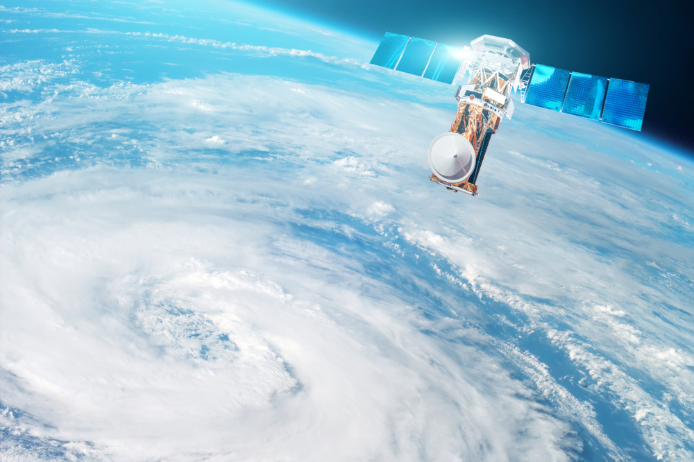
Earth Observation
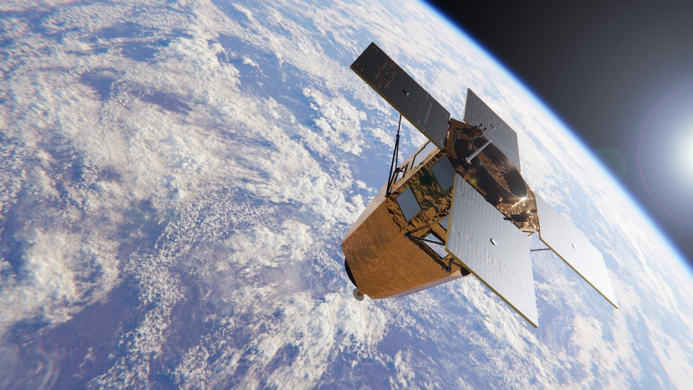
Satellites play a crucial role in Earth observation, providing high-resolution images and data that help scientists monitor and understand our planet’s environment. These satellites capture data on a wide range of phenomena, including weather patterns, land use, deforestation, glacier movement, and ocean currents. For example, the Landsat program, operated by NASA and the US Geological Survey, has been providing detailed images of Earth’s surface for nearly five decades. This data is invaluable for environmental monitoring, disaster response, and urban planning, offering insights that are impossible to obtain from the ground.
Weather Forecasting
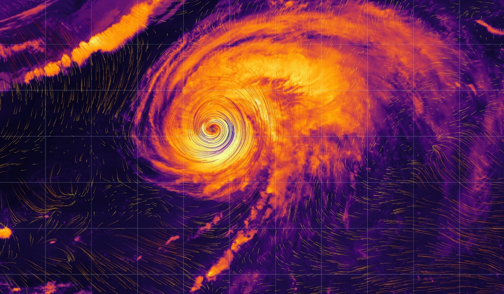
Weather satellites are essential tools for meteorologists, providing real-time data on atmospheric conditions that are used to predict the weather. These satellites monitor temperature, humidity, cloud cover, and wind patterns, enabling accurate weather forecasts and early warnings of severe weather events like hurricanes, tornadoes, and blizzards. The GOES (Geostationary Operational Environmental Satellites) series operated by NOAA is a prime example, offering continuous monitoring of the Earth’s atmosphere to improve weather prediction accuracy, which is crucial for public safety and economic planning.
Global Positioning System (GPS)

Satellites form the backbone of the Global Positioning System (GPS), which provides precise location and timing information to users worldwide. GPS satellites orbit Earth and transmit signals that are received by GPS devices, allowing them to calculate the user’s exact position. This technology is essential for navigation in aviation, maritime, and road transport, as well as for applications in agriculture, telecommunications, and emergency services. The U.S. Department of Defense operates the GPS constellation, which has become a vital tool in both civilian and military operations globally.
Telecommunications

Telecommunication satellites enable global communication by relaying signals for television, radio, internet, and telephone services across vast distances. These satellites are positioned in geostationary orbit, allowing them to provide continuous coverage to specific regions. They are crucial for broadcasting live events, enabling international phone calls, and providing internet access in remote areas where terrestrial networks are unavailable. Examples include the Intelsat and Inmarsat networks, which provide global communication services, supporting everything from media broadcasting to disaster recovery efforts.
Space-Based Astronomy
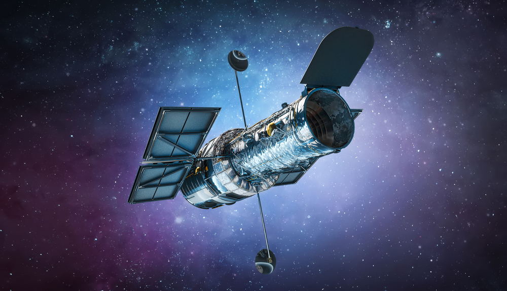
Satellites play a pivotal role in space-based astronomy, allowing scientists to observe celestial objects without the interference of Earth’s atmosphere. Telescopes mounted on satellites, such as the Hubble Space Telescope, capture images and data from deep space with unprecedented clarity. These observations have led to groundbreaking discoveries about the universe, including the confirmation of the expansion of the universe and the detection of exoplanets. Space-based telescopes can observe a wide range of wavelengths, including ultraviolet, X-ray, and infrared, providing a more comprehensive view of the cosmos than ground-based telescopes.
Earth’s Magnetic Field Monitoring
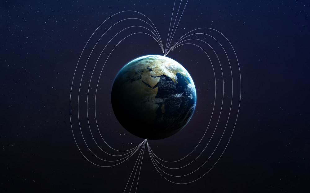
Satellites are essential for monitoring Earth’s magnetic field, which is critical for understanding the dynamics of the planet’s core and the effects of solar wind on the magnetosphere. Missions like the European Space Agency’s Swarm satellite constellation measure the strength, direction, and variations of the magnetic field, providing data that helps scientists study phenomena such as geomagnetic storms and their impact on communication systems and power grids. This data is also used to improve navigation systems that rely on magnetic field information.
Climate Change Monitoring
Satellites are at the forefront of climate change monitoring, providing long-term data on key indicators such as global temperature, sea level rise, ice sheet dynamics, and greenhouse gas concentrations. For instance, NASA’s Climate Change Monitoring Mission, which includes satellites like Aqua and Terra, provides critical data on the Earth’s climate system. These observations help scientists understand the rate and impact of climate change, informing policy decisions and aiding in the development of strategies to mitigate its effects.
Space Weather Monitoring
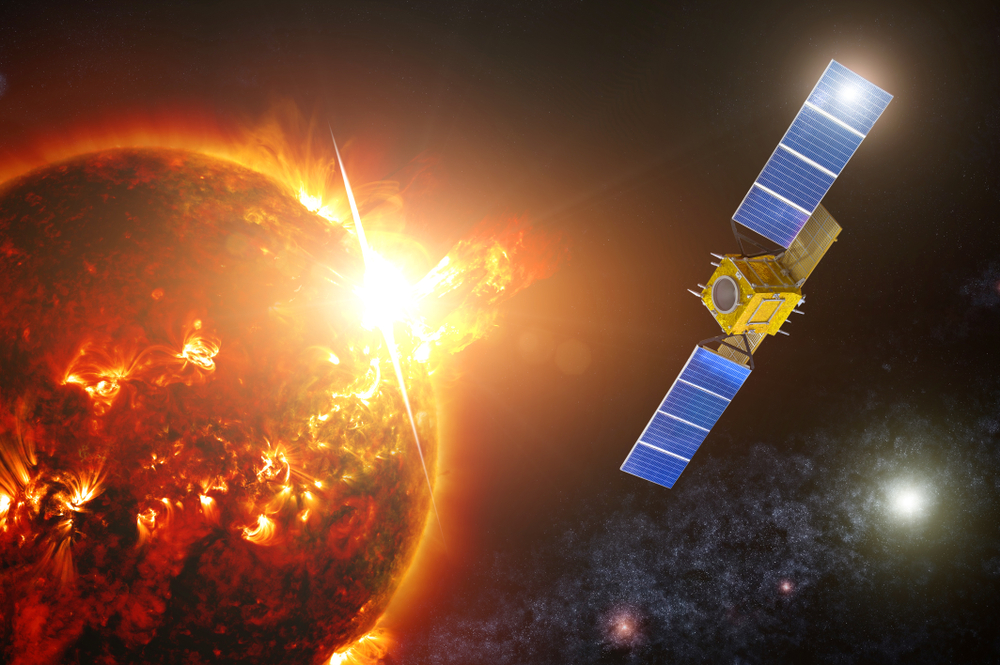
Space weather, which includes phenomena like solar flares and cosmic radiation, can have significant impacts on satellite operations, communication systems, and even power grids on Earth. Satellites like NASA’s Solar and Heliospheric Observatory (SOHO) monitor the Sun’s activity and provide early warnings of potentially harmful space weather events. This data is crucial for protecting satellites, ensuring the safety of astronauts, and mitigating the effects of solar storms on terrestrial technology.
Disaster Management and Response

Satellites are invaluable in disaster management and response, providing real-time data and imagery that help coordinate relief efforts and assess damage. For example, the International Charter on Space and Major Disasters uses satellite data from multiple agencies to support emergency response during natural disasters like earthquakes, floods, and wildfires. High-resolution images from satellites enable rapid damage assessment, helping to prioritize rescue operations and allocate resources effectively.
Environmental Monitoring
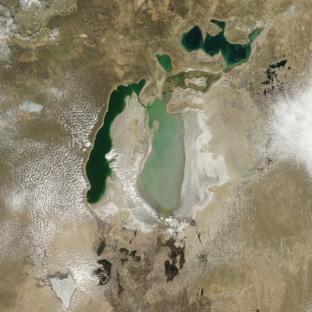
Satellites contribute significantly to environmental monitoring by tracking changes in land use, deforestation, desertification, and biodiversity loss. Programs like the European Space Agency’s Copernicus initiative use satellite data to monitor environmental changes on a global scale. This data is used by governments, NGOs, and researchers to implement conservation strategies, enforce environmental regulations, and study the impacts of human activities on natural ecosystems.
Oceanography and Marine Science
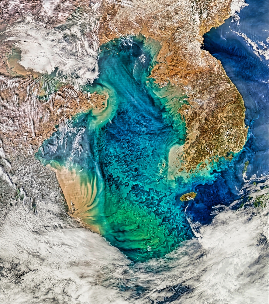
Satellites are crucial tools for oceanography, providing data on sea surface temperature, ocean currents, wave heights, and sea level changes. Missions like the Jason series of satellites, operated by NASA and CNES, have been instrumental in monitoring global sea levels and understanding ocean dynamics. This data is vital for climate studies, weather forecasting, and managing marine resources. Satellite-based ocean observation also supports disaster response, particularly in monitoring tsunamis and storm surges.
Navigation and Mapping

Satellites play a critical role in modern navigation and mapping, providing the data necessary for creating accurate maps and navigation tools. The combination of GPS satellites and Earth observation satellites enables the creation of detailed digital maps that are used for everything from urban planning to hiking in remote areas. Satellite-based mapping services like Google Earth rely on this data to provide detailed and up-to-date images of the Earth’s surface, aiding in everything from disaster response to everyday navigation.
Space Exploration and Interplanetary Missions
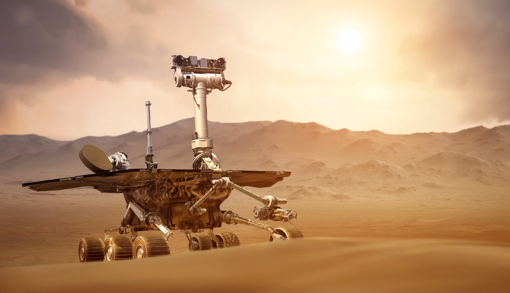
Satellites are essential for space exploration, serving as communication relays, navigation aids, and scientific instruments for missions to other planets and celestial bodies. For example, the Mars Reconnaissance Orbiter (MRO) has been orbiting Mars since 2006, providing high-resolution images of the planet’s surface and relaying data from rovers like Curiosity and Perseverance back to Earth. These satellites extend our reach into the solar system, enabling the study of planets, moons, and asteroids in unprecedented detail.
Global Internet Coverage

Satellites are increasingly being used to provide global internet coverage, particularly in remote and underserved regions where traditional infrastructure is lacking. Companies like SpaceX with its Starlink project, and OneWeb, are deploying large constellations of low Earth orbit (LEO) satellites to deliver high-speed internet access worldwide. These satellite networks aim to bridge the digital divide, enabling internet connectivity in areas that previously had limited or no access, and supporting global communication and economic development.
Space Debris Tracking and Management
As the number of satellites in orbit increases, tracking and managing space debris becomes crucial to prevent collisions and protect valuable assets. Satellites equipped with radar and optical sensors track debris in orbit, providing data that helps predict potential collisions and plan avoidance maneuvers. The European Space Agency’s Space Debris Office uses data from satellites to monitor and mitigate the risks posed by space junk. Effective space debris management is essential for the long-term sustainability of space exploration and satellite operations.
Monitoring Ice Caps and Glaciers

Satellites are essential for monitoring the state of Earth’s ice caps and glaciers, providing data on their size, movement, and melting rates. Missions like NASA’s ICESat-2 use laser altimetry to measure changes in ice thickness, helping scientists understand the impact of climate change on polar regions. This data is critical for predicting sea level rise and assessing the global climate system’s health. Satellite monitoring of glaciers also helps manage water resources, as melting glaciers feed many of the world’s rivers.
Carbon Dioxide and Greenhouse Gas Monitoring
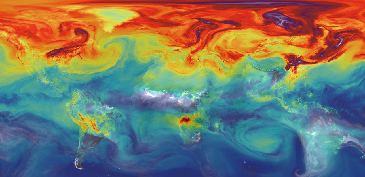
Satellites are critical in monitoring atmospheric concentrations of carbon dioxide and other greenhouse gases, which are key drivers of climate change. NASA’s Orbiting Carbon Observatory-2 (OCO-2) and the European Space Agency’s Sentinel-5P are examples of satellites that measure the levels of these gases across the globe. This data helps scientists track sources of emissions, understand their impact on the climate, and develop strategies to reduce greenhouse gas concentrations in the atmosphere. Accurate monitoring is essential for international climate agreements and efforts to mitigate global warming.
Wildlife Tracking and Conservation
Satellites play a vital role in wildlife tracking and conservation efforts, providing data on animal movements, habitat changes, and poaching activities. Satellite tracking collars are used on species like elephants and sea turtles to monitor their migration patterns and behavior. Additionally, Earth observation satellites provide data on habitat destruction, such as deforestation and urban encroachment, helping conservationists take action to protect endangered species. Programs like the Global Forest Watch use satellite data to monitor forest cover and biodiversity, supporting global conservation initiatives.
Supporting Astronomical Observatories
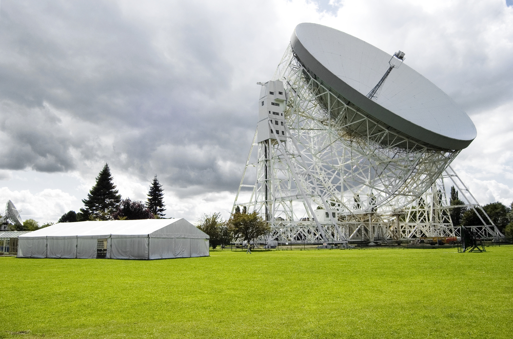
Satellites assist ground-based astronomical observatories by providing complementary data and enabling coordinated observations of celestial events. For example, space-based observatories like the Chandra X-ray Observatory and the Hubble Space Telescope can observe in wavelengths that are inaccessible from the ground, providing additional insights into cosmic phenomena. These satellites can also provide real-time alerts for transient events like gamma-ray bursts, allowing ground-based telescopes to quickly focus on the event. The synergy between space-based and ground-based observatories enhances our understanding of the universe.
Supporting Military and Defense Operations

Satellites are integral to modern military and defense operations, providing real-time intelligence, surveillance, and reconnaissance (ISR) capabilities. Military satellites can monitor troop movements, detect missile launches, and provide secure communication channels for defense forces. The U.S. Department of Defense operates a network of satellites that support global military operations, including the Defense Meteorological Satellite Program (DMSP) and the National Reconnaissance Office (NRO) satellites. These satellites play a crucial role in national security, enabling precise and timely decision-making in defense strategies.
This article originally appeared on MyCarMakesNoise.
More from MyCarMakesNoise
15 Luxurious Sedans Perfect for Comfortable Road Trips

Each model featured here is crafted to enhance your driving experience, ensuring that each mile traveled is as pleasurable as it is memorable. Read More.
Top 15 Motorcycles with Exceptional Fuel Efficiency for Long Rides

Featuring a range of models from lightweight adventure bikes to heavyweight tourers, each one ensures a reliable, comfortable, and economical ride, transforming every trip into a memorable adventure. Read More.
Top 20 Must-Have Accessories for Long-Distance Motorcycle Riding

From essential safety gear to comfort enhancers and ergonomic accessories, this guide explores crucial items that every long-distance rider should have to make every trip enjoyable and hassle-free. Read More.